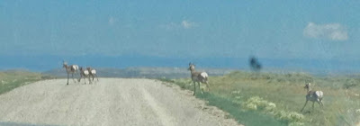
There is a road that goes east out of Alpine into the Bridger-Teton National Forest. It follows the Grey's River as it bends to the south, and about 30 miles from Alpine, intersects with a road that goes due east up and up over the Wyoming Range, through McDougal Gap, and then down into the high desert where you leave the National Forest and all trees behind, enter Sublette County, and go through a vast expanse of nothing but sagebrush, no sign of human habitation, no trees, maybe an occasional cluster of open range cattle foraging for whatever they can find among the sagebrush, and if you are lucky you might encounter a family of pronghorns crossing the road. This is all unpaved road. Eventually you descend into "civilization," hit pavement, intersect with US highway, and swing north through Bondurant and west over to Hoback Jct., and then SW to Alpine again, about 100 miles and 5-6 hours in all. It's a gorgeous ride, a bit bumpy at times, but not bad. Ellen and I drove it Wednesday in Paul's pickup truck. It was a fantastic tour of the diversity of Wyoming scenery.
The Grey's River
Man Peak from Grey's River Road
Memorial to a Wyoming state patrolman who died in 1981 at age 30 when his vehicle was rear-ended by a drunk driver. Patrolman Visser was investigating a crash at the time.
A sea of wildflowers near McDougal Gap
 |
| Sublette County - Wind River Range in distance |
Pronghorns in the road


No comments:
Post a Comment